


An engineering team from New Zealand’s Massey University won its category at a global competition in New York City for an air-quality project.
According to a recent press release, the team submitted its Climate Air Information Real-time Network (CAIRNet) project, which is an air-quality monitoring network to the Smart Land category.
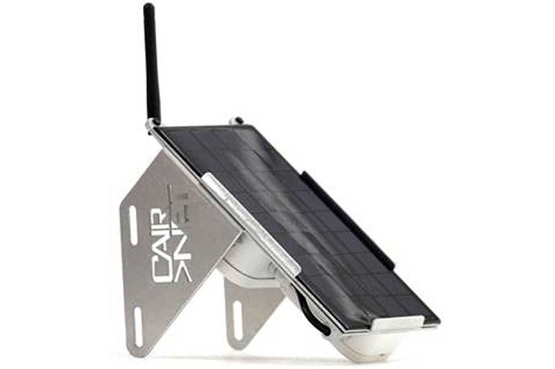
The network is capable of using cost-effective sensors to measure carbon monoxide, nitrogen dioxide, particulate matters, temperature, and humidity.
An Internet of Things (IoT) Innovation Challenge asked teams from around the world to conceptualise a low-power sensor network to tackle the world’s rapid urbanisation in either a Smart Land or Smart Water category.
The team had minutes to convince the judges of the network’s benefits.
They were awarded US$ 25,000 for winning their category. The University, meanwhile, will also receive US$25,000 worth of test equipment from the company in charge of the event.
The Problem
The group’s supervisor explained that air quality monitoring stations are currently confined to only a small number of locations due to the high cost of the monitoring equipment.
They provide a low-fidelity picture of the air quality in the city. However, local variations and pockets with high densities of pollutants are overlooked.
The Solution
CAIRNet can help measure air quality, in real-time, at a large number of urban locations in a cost-effective way.
Each sensor is capable of long-range and low power communication over a network of Internet of Things (IoT) as well as short-range, high-data rate communication over Wi-Fi.
It is solar-powered, weather-resistant and designed to be easily deployed at a large number of locations.
The data collected from the sensor nodes are stored in a cloud-based server and is ultimately displayed on a web page for end-users.
The Benefits
Real-time air pollution data can raise awareness of the general public that could lead to the uptake of sustainable living.
Moreover, it can be an effective tool for the government and the policy makers for minimising air pollution.
The work has impressed air quality scientists from the National Institute of Water and Atmospheric Research and other government agencies.
In addition, it has received funding from the Massey University Research Fund and the Ministry of Business, Innovation and Employment (MBIE) Product Accelerator Fund.
Hyperspectral and thermal remote sensing
In other news, a one-day workshop at the University will discuss the benefits of hyperspectral and thermal remote sensing technologies for underground research.
18 speakers will be covering remote sensing applications in volcano research, soil and environmental management, geothermal and minerals exploration, and natural hazards assessment at the workshop called, “Hyperspectral and Thermal Remote Sensing: from data to applications.”
The gathering has attracted representatives from regional councils, government agencies, universities, crown research institutes and international researchers.
The workshop coordinator explained that hyperspectral remote sensing is very new to New Zealand.
Remote sensing is a fast and non-invasive approach. It provides large volumes of data with no harm to the environment, making it an excellent new tool to monitor changes of geothermal systems over time.
Because of the wealth of data captured by the hundreds of spectral bands, it will also provide a much detailed understanding of the geology, hydrogeology, heat and vegetation interactions.
Hyperspectral sensing forms images of reflected light beyond the eye’s vision at many narrow wavelength channels, sharing information about the chemical and physical properties of the earth’s surface.
Thermal remote sensing measures, on the other hand, radiation emitted by the Earth surface in the form of heat.
These two techniques, when combined, can tell a complex story of hydrothermal alteration, chemical-composition of the ground, vegetation structure and thermal waters, in particular for geothermal areas of New Zealand.


