


According to an National University Singapore (NUS) report, Singapore has warmed notably since the mid-1970s when rapid urbanisation took place, at a rate of 0.25 degrees Celsius per decade according to the Meteorological Service Singapore.
“The rate is higher than the global average rate of 0.17 degree Celsius per decade since 1970, based on data from the United Nations Intergovernmental Panel on Climate Change. If the current urban development approach remains unchanged, local warming will lead to a rise in electricity demand for cooling and the risk of residents suffering from heat stress.”
Study to help find out how to keep Singapore cool and improve urban climate resilience
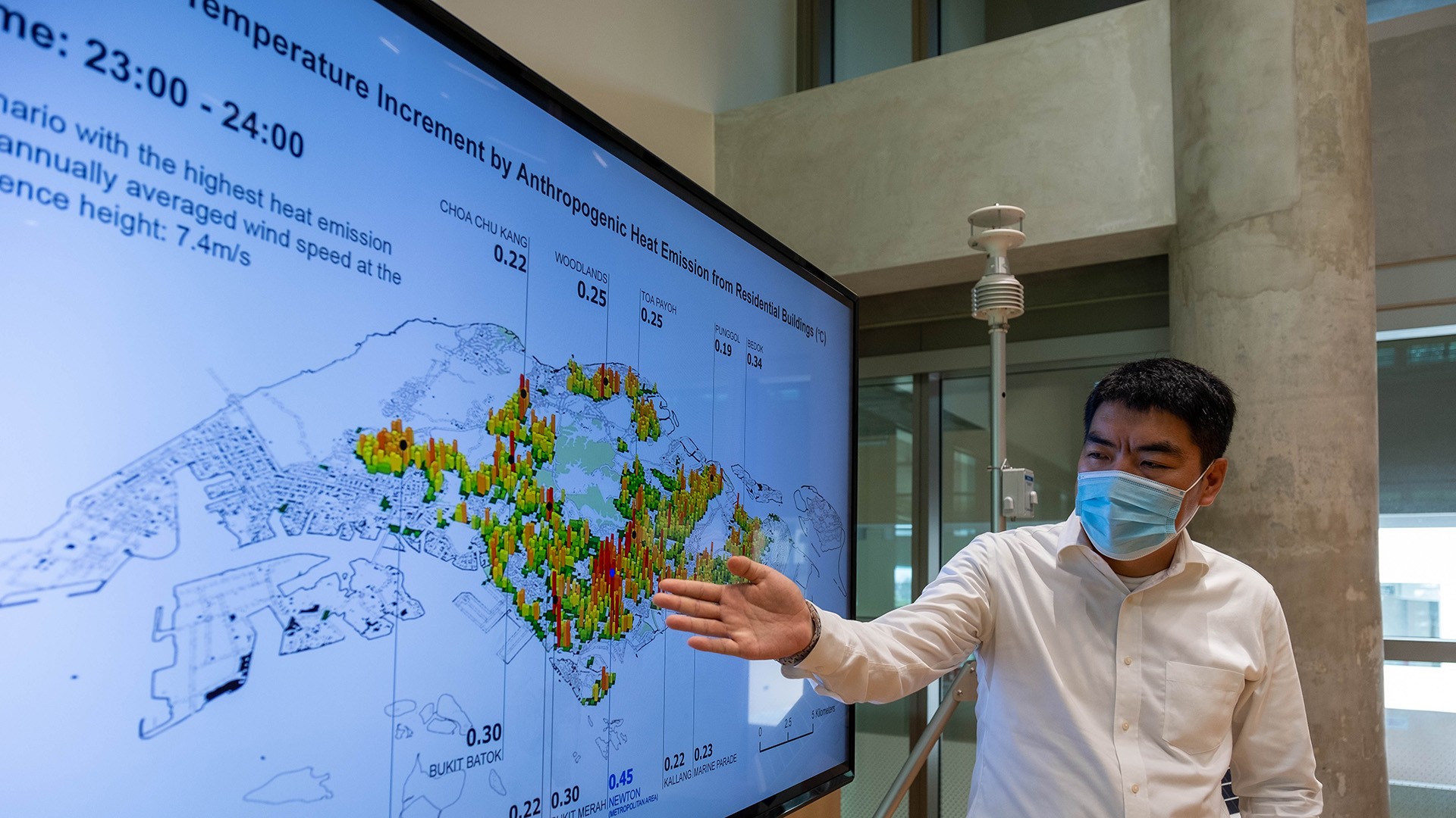
Presidential Young Professor Dr Yuan Chao from the Department of Architecture at the NUS School of Design and Environment led a team to examine the heat balance in the street canyon – where the street is flanked by buildings on both sides – and developed a user-friendly Geographic Information System (GIS) tool to estimate the impact of urban planning on anthropogenic heat dispersion.
Dr Yuan Chao, Dr Mei Shuojun, Dr He Wenhui and Ms Zhang Liqing investigated the transient street air warming procedure and developed a practical GIS-based model to estimate how much and how fast the air temperature will be increased by anthropogenic heat.
Dr Yuan observed, “The air temperature increment in residential areas could be even higher in the future due to rapid global warming and urban development. It could increase the risk of residents in tropical cities suffering from more frequent and intensive long-term heat stress and short-term heatwaves.”
Dr Yuan said that “Due to the huge uncertainty caused by urbanisation and global warming, the new GIS-based analytical model is a feasible tool to deal with numerous microclimate scenarios to help Singapore stay cool.”
Next steps – tackling heat problems globally
The model can be easily adopted in cities overseas. By connecting this model with global and regional scale models, city-level findings can also be used to tackle heat problems globally.
The team will explore working with other research teams working on global and regional scale models in the near future. They have also identified air pollution as another important urban climate issue that will also be integrated into this GIS tool.
PHOTO CREDIT: https://news.nus.edu.sg/
Photo: Dr Yuan Chao showing the results of air temperature increase by anthropogenic heat in various regions using the GIS tool developed by his team.


