


Geoscience Australia recently led
a large collaborative effort with 16 different research teams from Australia
and Germany, working to improve the accuracy of local-scale greenhouse gas
emissions quantification techniques.
The study demonstrated that using a combination of
techniques provides a more accurate estimate of possible greenhouse gas
emissions rather than relying on a single technique.
By using a combined approach more accurate estimates can be
generated for input into Australia's National Greenhouse Accounts.
The study is described as one of the most comprehensive
assessments of atmospheric techniques used to estimate emission rates ever
undertaken. Participants in the trial along with Geoscience
Australia included University of Wollongong, University of Melbourne, Macquarie University, CSIRO Energy, CSIRO Oceans and
Atmosphere, Western Sydney University, CSIRO Data 61, University
of Adelaide, CSIRO Mineral Resources, University of Western Australia, National Geosequestration Laboratory, Bruker Optik, FLIR, Department of
Industry, Innovation and Science and CO2CRC.
Being able to measure fugitive greenhouse gas emissions is
important for supporting national and global greenhouse gas reduction targets.
It is essential to have confidence in the techniques used to estimate methane
emissions from the energy and agricultural sectors, natural greenhouse gas
seepage, or potential carbon dioxide leakage from geological storage projects (CO2
can be injected into into underground geological formations, such as Oil fields,
gas fields, saline formations, unmineable coal seams to prevent it from
escaping to the surface).
However, monitoring the effectiveness of geological storage
of CO2 is challenging because CO2 is present naturally in the atmosphere, soil,
ocean and groundwater.
A methane and carbon dioxide release experiment was undertaken
at the Ginninderra Controlled Release Facility in Canberra, Australia from
April to June 2015. Eight different quantification techniques were simultaneously
compared to determine the effectiveness of both stationary and mobile methods,
and included a blind study where the actual release rate was unknown.

Project leader, Dr Andrew Feitz explained that each of the
research teams used different measurement techniques and models to produce an
estimate of the actual release rate without knowing the true value. The
individual estimates varied greatly, but by bringing all of the results
together the researchers were able to produce a much closer estimate of the
release rate.
"In the methane release experiment, not one of
uncertainty ranges for the estimates from eight different techniques contained
the actual release rate," Dr Feitz said.
"By applying a combined approach, like those used in
weather forecasting and climate models, we were able to greatly improve the
accuracy of the estimate and provide an uncertainty range that contained the
actual release rate," he added
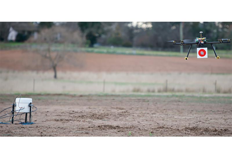
Many novel and promising techniques were deployed for
estimating the emission rate and also for gas detection and mapping
applications. These techniques are not yet as sensitive as high precision gas
analysers, but the performance of miniaturised sensors is improving rapidly.
This technology offers considerable potential for mobile applications,
including automating gas monitoring and leak detection using ground robots or
unmanned aerial vehicles.
The study successfully demonstrated that is it possible to
use airborne detection of a small CO2 leak using a small helicopter UAV (unmanned aerial vehicle or drone).
By
using drones, the number of expensive high accuracy sensors necessary can be
reduced to one piece per drone. The spatial coverage is limited only by the
robot’s on-board power. A sparse temporal resolution can be addressed by
repeatedly sending the same drone into the field or by alternating drones with
identical configuration. It also allows the operator to stay in a safe
distance. With autonomous operation the operator can concentrate on the results
received from the robot while not being present at the emission site at all. Current
work is focusing on automating the aerial platform to enable autonomous flight
for coverage over larger areas, the tracking of gas plumes as well as the
creation of CO2 distribution maps for different altitudes.


