


A new smart technology platform was launched in Bendigo, Victoria that will help residents keep cool this summer by mapping the location of urban hot spots in the city to avoid on hot days.
According to a recent press release, Australian cities are widely known for their liveability, yet extreme heat can be a killer with inland regional towns being most vulnerable.
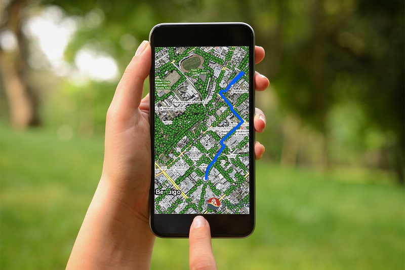
About the Platform
RMIT University researchers developed a new digital platform, which uses Google Street View images and satellite heat images to show which streets and routes are more likely to be shadier and cooler for pedestrians and cyclists.
The Shadeways platform will enable residents to move in comfort and safety.
Associate Professor Marco Amati, project leader, explained that temperature acts as an obstacle and impedes active travel such as walking and cycling.
The app is responding to the public’s need to travel through cool routes, especially with the growing number of hot days.
It puts information about the cool areas in a city in the hands of people, enabling them to map a cooler route through the City of Greater Bendigo.
The will provide users with the ability to stay outside and take part in active travel for longer periods of the day.
Utilising Innovation and Tech to Improve the City
Senator for Victoria the Hon Sarah Henderson, who attended the platform’s launch event, shared that the project is an innovative and clever way to keep the Bendigo community safe during summer.
Innovative solutions such as this platform will help boost community resilience to heat and extreme weather.
The urban heat maps will help inform where to prioritise street tree planting, with The City of Greater Bendigo drafting a plan to increase tree cover throughout urban areas and townships for release in early 2020.
City of Greater Bendigo Mayor Margaret O’Rourke explained that data and technology can dramatically improve city planning and approaches to managing climate change.
Understand where the hottest and coolest streets are will help the city government to reduce hot spots by planting trees and cooling the city.
This will be helpful in improving the overall health and wellbeing of pedestrians, particularly vulnerable people such as the very young, elderly and disabled.
According to the project leader, the project’s technology and concept are completely scalable and is already being adopted in a pilot for the City of Melbourne’s innovation district as an extension.
Collaboration is Key
Solving issues like extreme heat in the cities is best done when researchers and innovators work closely with both local communities and governments.
This kind of partnership ensures the solutions that were developed are relevant and supported to succeed.
The project is part of the Australian Government’s Smart Cities and Suburbs Program in partnership with La Trobe University, City of Greater Bendigo, Shanghai Qijing Planning Architecture and Design, and Spatial Vision Innovations Pty Ltd.


