


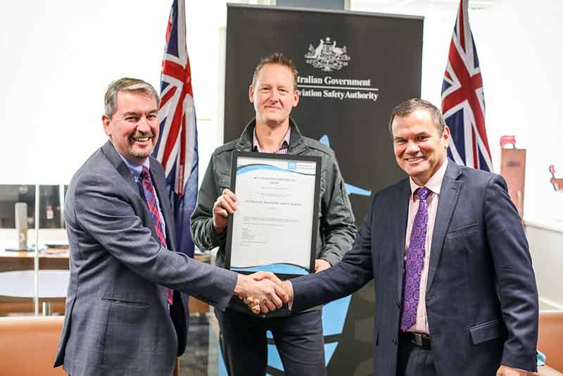
Above photo: (L-R) CASA acting Chief Executive Officer / Director of Aviation Safety Graeme Crawford; Transport Safety Investigation Manager Derek Hoffmeister; CASA acting Chief Executive Officer / Director of Aviation Safety Graeme Crawford, ATSB Chief Commissioner Greg Hood (Photo credit: Australian Transport Safety Bureau)
The Australian Transport Safety Bureau (ATSB) acquired a Remotely Piloted Aircraft Operator’s Certificate from the Civil Aviation Safety Authority (CASA).
This means that the agency now has the necessary approvals to gather data and evidence during its on-site investigations using Remotely Piloted Aircraft Systems (RPAS), commonly known as drones, up to seven kilograms.
The ATSB has already taken advantage of these qualifications. It captured investigative footage via its RPAS after a loaded coal train derailed between Oakey and Jondaryan in Queensland on July 21, 2017.
The Certificate was presented to ATSB Chief Commissioner, Greg Hood and Transport Safety Investigation Manager, Derek Hoffmeister on Friday 21 July by CASA acting Chief Executive Officer / Director of Aviation Safety Graeme Crawford. Mr. Hoffmeister has also been granted Chief Remote Pilot status by CASA, after passing the required flying test and interview.
Several transport safety investigators from ATSB are now qualified to fly the DJI Phantom 4, which has been assessed as most suitable for the ATSB’s RPAS operations.
The investigators have received a thorough grounding in theory and practical training. Theory covered the core components of RPA operations, aerodynamics, and safety, as well as the importance of weather and airspace considerations, and regulations that cover the RPA in Australia. Practical training was conducted on an empty sports field, with a course of coloured cones laid out. A key element of the exercise was working as teams, with a spotter monitoring the surrounding environment, while the pilot focussed on the RPA.
The use of RPAS results in substantial cost saving and ease-of-use benefits to the ATSB, compared to traditional site survey techniques, equipment and software. RPAS are highly useful for examining points that would be inaccessible for investigators, especially elevated or precarious locations.
Through the use of the RPAS, investigators are now able to undertake an initial site survey to check for safety hazards before entering the site. They can perform site mapping more quickly and with more accurate measurements and comprehensively photograph an entire accident site. Previously, such imagery could previously only be obtained with a helicopter.
In addition to building its RPAS capability, the ATSB is also conducting research and data analysis into this emerging technology to assess the safety risk to aircraft. There have been a number of ‘encounters” between RPAS and fixed and rotary winged aircraft, which is a focus of the ATSB.
Chief Commissioner Greg Hood said the agency has been monitoring the potential benefits of RPAS for a number of years. However it was only recently that advances in technology made this a viable option for the ATSB.
He said, “RPAS are now software-equipped and capable of high-fidelity resolution photography enabling accident site safety assessment, and site and debris mapping. While the size of our RPAS is below the threshold for an Operator’s Certificate, we are ensuring that we operate under CASA’s regulatory framework in the safest possible manner by gaining the qualification.”
“I urge those who have procured an RPAS or are interested in doing so to educate themselves on the CASA regulations. People who are flying RPAS commercially should follow the lead of the ATSB and gain their Remote Pilot Operator’s Certificate, regardless of the size of the RPAS they’re using. This will afford them the flexibility and preparedness to fly any kind of drone or deal with any changes to rules or regulations,” Chief Commissioner Hood added.
In addition to obtaining the Operator’s Certificate, ATSB will also be codifying in-house procedures and checklists for investigators to ensure that when these aircraft are deployed, it’s done safely and effectively.
Recently, CASA launched a new safety App, called ‘Can I fly there?’ to inform recreational drone users of safety regulations and help them identify no-fly zones.
In June 2017, CASA released the Terms of Reference for the review of aviation safety regulation of RPAS.


