


The coast of Aotearoa New Zealand kills around five people each year because of the rip currents around the area.
Surf lifeguards attribute around 85% of their rescues, which is approximately 700 per year, to these fast offshore flows of water.
According to a recent press release, a cutting edge technology that will try to understand these hazardous currents in order to better predict their occurrence is being employed by University of Canterbury (UC) Coastal Geomorphologist Dr Seb Pitman.
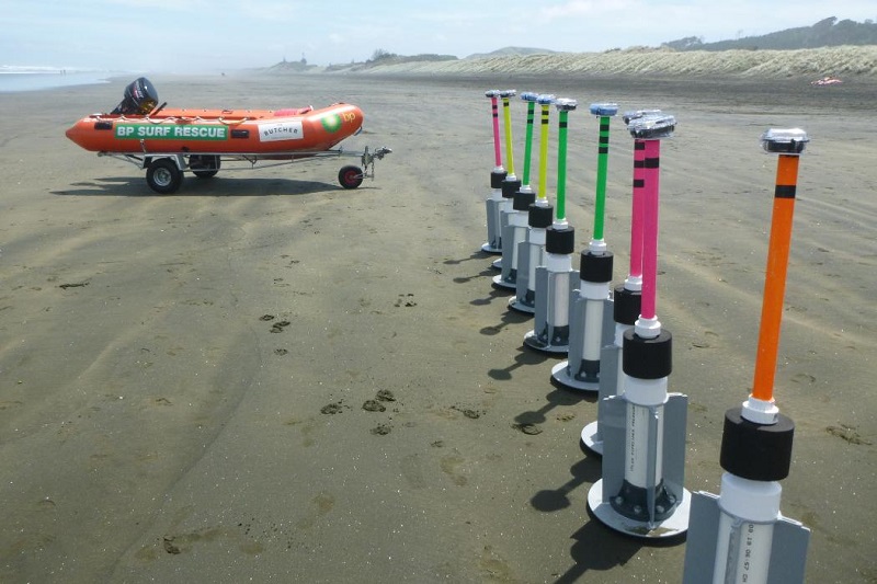
In conjunction with Surf Life Saving Northern Region and Plymouth University in England, a research team is currently deployed at Muriwai beach northwest of Auckland.
They are tracking the currents using GPS-enabled surfzone drifters, which are designed to mimic someone floating in the water.
The GPS provides information on current speed in the surfzone as well as their circulation pattern, allowing researchers to quantify the hazard posed at any given time.
What the team is really trying to pinpoint is the threshold at which wind, wave and tide conditions can all conspire to turn the rip current on or off.
By comparing current speeds and circulation patterns to the wave height, wind direction, and tidal stage, they are hoping to come up with a predictive index for hazardous conditions.
The research is part of Auckland Council’s Safeswim platform, which is a website and mobile app that provides real-time information on water quality at beaches around Aotearoa New Zealand.
It is a ‘one stop shop’ for advice on beach conditions that helps Auckland beach users to make informed decisions about when and where to swim before heading to the beach.
Moreover, it provides real-time data on the performance of the wastewater and stormwater networks, forecasts of water quality, and up-to-the-minute advice on swimming conditions at nearly 100 sites around the Auckland region.
The team hopes to be able to integrate a beach hazard component to the platform in the near future.
The purpose is not to ‘red flag’ beaches and to prevent their use. Instead, it simply wants to make people stop and think when they get to the beach.
If they arrive and a warning is shown about rip currents being particularly hazardous that day, they are now equipped with the information on hand to make an informed judgement.
They can choose whether they really want to go into the water, and if they do, then to carefully consider where might be best to swim.
The study is scheduled to conclude in mid-February 2019, with the goal of developing real-time hazard prediction by next summer.


