


|
Getting your Trinity Audio player ready...
|
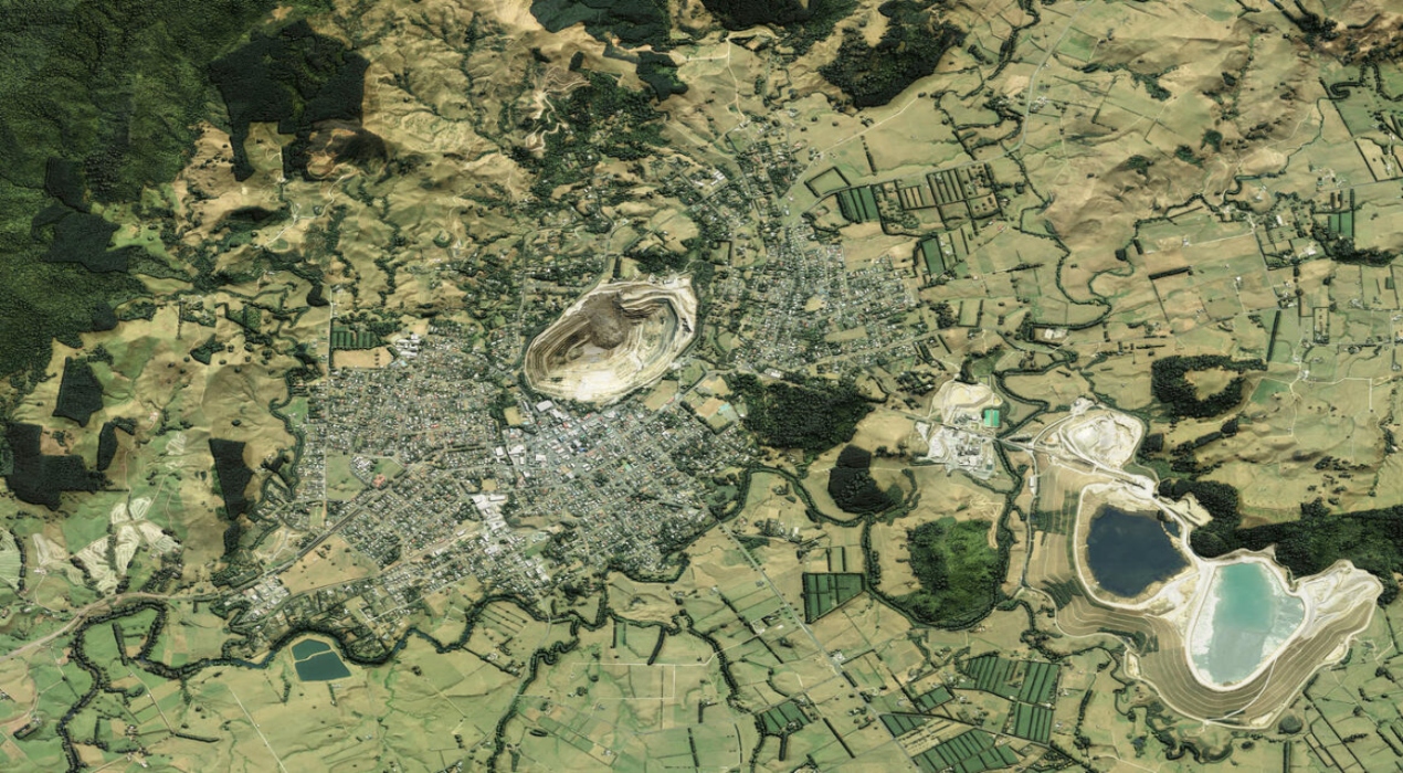
The recent release of three-dimensional mapping data for Waikato and Southland has unlocked more than half of New Zealand’s landscape for extensive investigation, with this valuable dataset available for free through the Toitū Te Whenua LINZ Data Service, representing a significant advancement towards the goal of achieving detailed 3D imagery coverage for 80% of the entire country. This release shows a significant advancement in making detailed geographical information widely available and serves as a pivotal contribution to the broader mapping initiatives.
According to Bjorn Johns, the Technical Leader at Toitū Te Whenua, a substantial and ever-increasing demand exists for this data from various sectors within New Zealand. Local government bodies, private companies, academic institutions, and Crown Research Institutes eagerly seek access to this valuable information. As the coverage of this data expands across the nation, the demand for it continues to surge, underscoring its significance and the wide array of applications it supports.
Light detection and ranging (LiDAR) technology plays a pivotal role in the comprehensive acquisition of high-definition data pertaining to the land’s topography. This sophisticated technology emits pulsed laser beams, measuring variable distances to the Earth’s surface. When these laser pulses are coupled with additional data, they synergistically generate intricately detailed three-dimensional maps, commonly called digital elevation models.
Bjorn emphasised the invaluable nature of these datasets for local councils and regional industries, serving as essential tools for meticulous planning and strategic land management. Furthermore, these datasets are immensely beneficial for tasks such as flood and landslide hazard mapping, intricate engineering design, and creating immersive 3D visualisations.
Mr Johns underscored the significance of having a baseline dataset, as it substantially facilitates assessing changes resulting from significant events such as earthquakes and severe weather incidents. When areas are resurveyed, the new images can be meticulously compared with the foundational dataset, leading to a deeper understanding of the precise impact of these events. This wealth of information significantly bolsters emergency response and recovery efforts, enhancing the region’s resilience in the face of unforeseen calamities.
The recent release of LiDAR data for the regions of Waikato and Southland complements the existing collection of data that has been meticulously gathered and made accessible through a project that receives co-funding from both regional councils and Kānoa, which serves as the Regional Development and Investment Unit within the Ministry of Business, Innovation, and Employment (formerly recognised as the Provincial Growth Fund). This comprehensive project, initiated in 2018, is projected to reach its culmination by 2024.
According to Andrew Ferrel, the Manager of Partnership Programmes at Toitū Te Whenua, there is a profound sense of achievement in attaining the significant milestone of 50% coverage and observing the practical utilisation of this valuable data.
The data supports the innovation, providing businesses and various other operators with unfettered access to intricate and detailed information that would otherwise remain beyond the reach of many.
The substantial expansion of the New Zealand National Elevation Programme is being facilitated through co-funding from Kānoa – RDU. This ambitious endeavour is built upon robust partnerships forged between Toitū Te Whenua and councils spanning all 16 regions of New Zealand.
Emory Beck, a Location Data Analyst, is actively engaged in ensuring the quality control of the recently acquired data. Beck expresses the fascination that comes with early access to such detailed data covering specific parts of the country, revealing a multitude of diverse landforms and relief features that have been, in a sense, unveiled by the elevation data.
It is crucial to note that the data collected through the PGF-LiDAR programme, in collaboration with Toitū Te Whenua and the councils, is open and available to everyone, fostering transparency and inclusivity in utilising this valuable resource.


