


The National Parks Board (NParks), the Elections Department of Singapore (ELD), and the Singapore Land Authority (SLA) all use advanced technology and a team from GovTech tagged as the Modelling and Simulation (M&S) team to manage enormous areas of land across the country. The cross-agency division combines knowledge of geospatial information systems, data, 3D visualisation, and other technologies to help with city planning and administration.
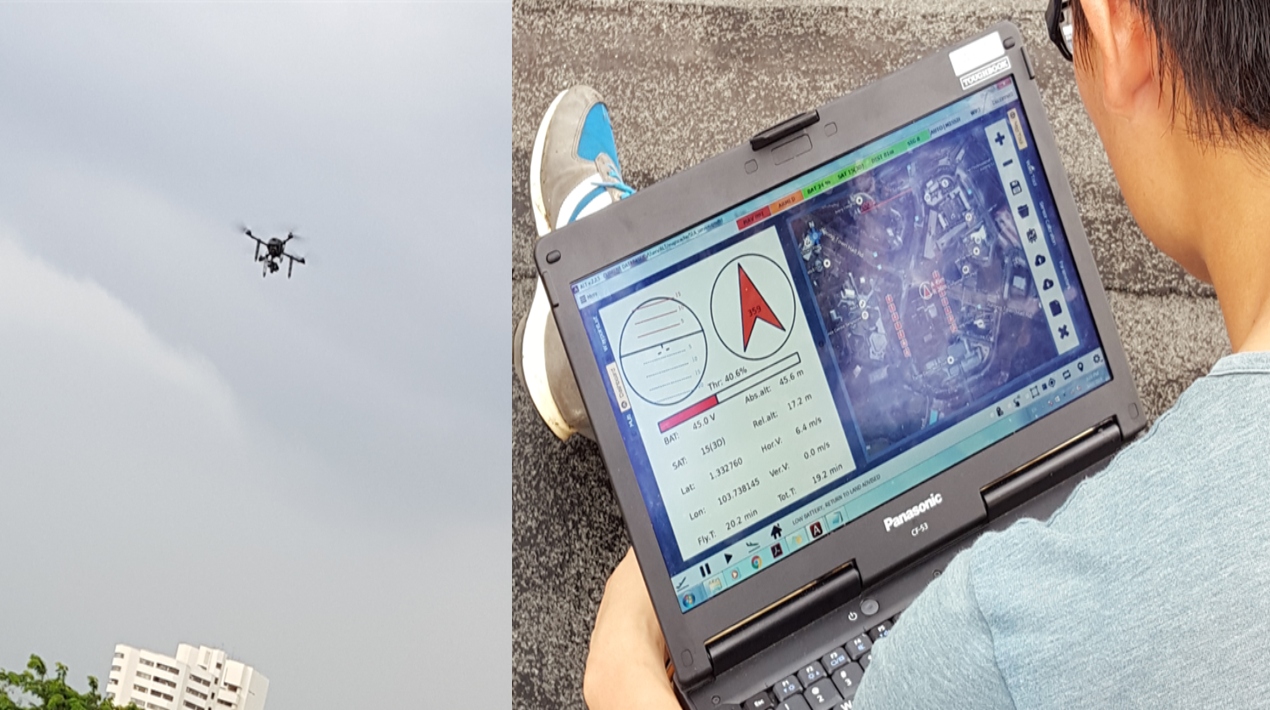
SLA‘s main responsibility is to maintain state-owned land and property. To complete this labour- and time-intensive task, the agency began utilising drones and machine learning (ML) in 2016. After all, drones can travel great distances much more quickly than people. They can also quickly reach areas of buildings that are inaccessible by ground-level visual inspection. Drones eliminate the need to use equipment like cherry pickers, boom lifts, and truck cranes, which may not be able to access difficult-to-reach areas. Additionally, drones can be used to scan areas with thick vegetation.
Roy New, Senior IT Manager at SLA, claims that because officers are less likely to be bitten by insects and be exposed to heights during their inspection work, especially on state land with dense vegetation, the overall safety risk they face is significantly reduced. Additionally, SLA officers can view images taken by drones while on the move and the enormous amount of data produced by contemporary systems is employed effectively.
To visualise the building and its general location, photogrammetry is also used to create 3D objects. Instead of looking at pictures of just grass patches or grey walls and trying to figure out where the picture was taken, officers can quickly locate maintenance issues with the help of the map and 3D view. As a result, physical inspection no longer needs to take eight hours but just one. Additionally, it is predicted that early maintenance issue detection can cut repair costs by as much as 40 per cent.
On the other hand, the ELD, which organises and oversees Singapore’s elections, works with a lot of data from various source organisations. The population within a constituency, for instance, determines its size and composition, so the department needs to have current residential data.
Derrick Ong, Geospatial Information System Architect at ELD, shared that the team’s ability to access data and collaborate more easily has been made possible by the recent switch to a cloud-based system, which has decreased the amount of manual work required for data preparation. Utilising geospatial data to plan and visualise electoral boundaries, which are updated prior to each general election, is another aspect of ELD’s work.
With the aid of technology, election officials can more efficiently set up voting locations for citizens, including polling places within each constituency, ensuring a fair distribution of voters to reduce the likelihood of long lines forming.
Moreover, the 350 parks and gardens on the island saw a sharp rise in visitors after Singapore implemented Covid-19 safe management measures, such as restricting access to shopping centres, as people turned to green spaces for recreation.
NParks and GovTech worked together to create a public portal with a map in response to this increase in foot traffic. NParks was able to efficiently manage visitor levels and enhance parkgoers’ experiences by utilising geospatial tools, security cameras, and other technologies.
In the end, all the teams concur that creating a digital public sector can be a difficult and drawn-out process. However, they also think that the discomfort is worthwhile because of the tremendous long-term benefits of digitisation, and they find it satisfying when users recognise the work and advantages the new system offers them: greater convenience that enables the public sector to improve lives.


