


New Zealand’s Christchurch City Council is now the proud owner of the world’s largest detailed local groundwater monitoring network.
According to a recent press release, the Council has been gifted the network by the Earthquake Commission (EQC).
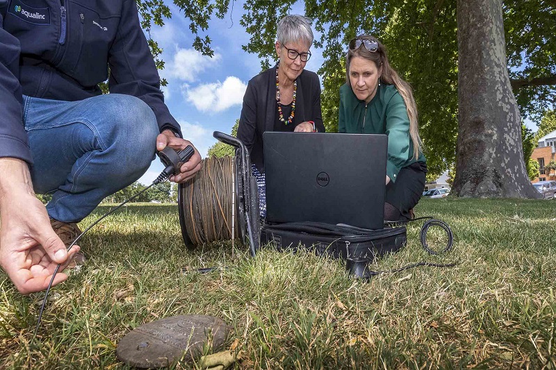
Christchurch City Council Groundwater Monitoring Network
The sophisticated Christchurch City Council Groundwater Monitoring Network is made up of about 650 measuring boreholes. There are about 250 with high-tech sensors.
The ground water monitoring network was set up by EQC to measure the temporary changes in shallow groundwater below the areas most affected by the Canterbury Earthquake sequence.
The scale of the network and the level of data it can produce are believed to be unique in the world.
Dr Jo Horrocks, the Head of Resilience Strategy and Research at EQC, explained that through the sensors, unprecedented levels of detailed local groundwater data were used to inspire the research and modelling of scientists, as well as colleagues at GNS, the Christchurch City Council and Environment Canterbury.
The data is gathered every 10 minutes.
Background
The network was initially installed as a means to better understand the localised impact of changing water levels in order to help determine the increased liquefaction and flood vulnerability and pay-outs for land damage.
Because the Commission has concluded its three-year research project, it has now gifted the network to the Christchurch City Council.
The sensors will continue to provide huge amounts of precious data that can help scientists, city planners and policymakers to understand, predict and prepare for the future.
Benefits of Groundwater Monitoring Network
More severe weather events are on the horizon because of climate change and having this monitoring network will help to better understand the localised impact on shallow groundwater and land drainage.
Council Head of Three Waters and Waste Helen Beaumont shared that they are glad to receive the network in collaboration with Environment Canterbury, which will also contribute towards the cost of ongoing monitoring and data collection.
Environment Canterbury is developing systems to enable the data to be fully available to the public on its website.
The sensors were a significant investment by the Crown at around NZ$ 600 apiece but provide significantly more accurate data and more efficiency than the manual process.
Dr Horrocks added that the sensors have many more years of valuable use left in them and it is fantastic to see that they can be used for other purposes.
Who are Involved?
The Earthquake Commission is a New Zealand Crown Entity investing in natural disaster research, education and providing insurance to residential property owners.
Environment Canterbury works within the local government in New Zealand with the purpose of facilitating sustainable development in the Canterbury region.
Collecting valuable information is significant as it helps in research and decision-making processes.
Initiatives Across the Globe
OpenGov Asia earlier reported on Ho Chi Minh, Vietnam to be fully covered by IoT network. All of the city’s districts will have IoT broadcasting stations, making it the first city in Vietnam fully covered with an IoT network.
Additionally, smart monitoring has also improved forest care at the National Arboretum when researchers from Australia’s University of Canberra designed and installed a state-of-the-art Smart IoT Platform to monitor pertinent soil data at the Arboretum.
The system optimises irrigation and promotes greater tree growth while curbing water wastage.


