


Researchers from the University of the Philippines, Diliman campus harnessed the power of satellite images to create an online community-based assessment tool to gauge the presence of blue carbon in coastal areas.
According to a recent press release, the Integrated Assessment and Modelling of Blue Carbon Ecosystems for Conservation and Adaptive Management (IAMBlueCECAM) program produced an accurate and detailed inventory of mangrove forests and seagrass habitats in selected pilot sites using remotely-sensed data and ground-based measurements as one of its major outputs.
In addition to extent, blue carbon ecosystem zonation, species composition, and above-ground biomass were mapped using methodologies developed by the program.
The program is being led by Dr Ariel C. Blanco and has funding support from the Department of Science and Technology- Philippine Council for Industry, Energy and Emerging Technology Research and Development (DOST-PCIEERD).
Background of the project
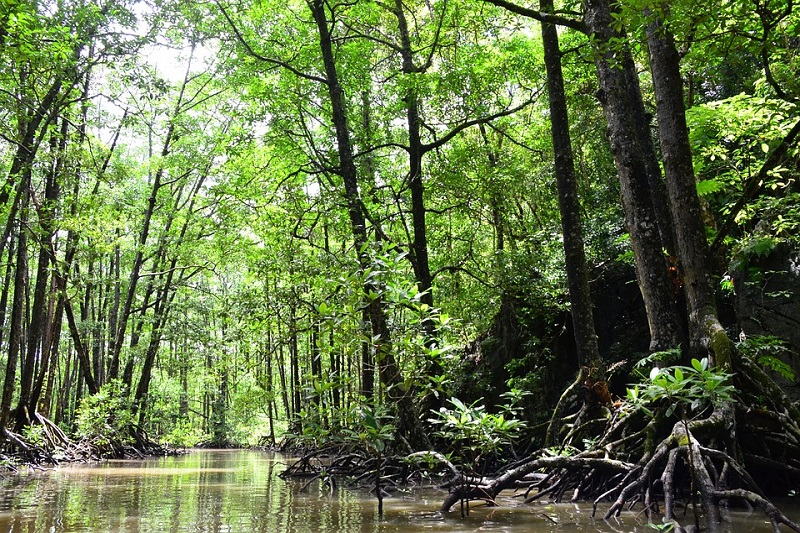
Blue carbon refers to the carbon captured and stored by the coastal ecosystems, specifically mangroves and seagrasses, which are also called carbon sinks, for million years.
When these ecosystems are degraded, they release the captured carbon back to the atmosphere, thus greatly contributing to climate change.
It will therefore be beneficial for everyone if the mangroves and seagrasses are conserved and protected.
Once the maps and other outputs are used by local government units (LGUs), local officials can gain information on the mangrove extent and species present in the area.
Having this knowledge will help them in its conservation and effective management.
Study sites are Coron, Busuanga and Puerto Princesa in Palawan, Ibajay, Batan, and Kalibo in Aklan, and Banate Bay in Iloilo.
Significance of mangrove conservation
Local governments need to recognise the importance of these blue carbon ecosystems. Its non-use was valued at over US$ 669,593.72 (PHP 35 million) per hectare in Puerto Princesa, Palawan.
This is 20 times higher than the use of its wood for fuel.
DOST-PCIEERD Executive Director Dr Enrico Paringit said, “We hope that this number alone can encourage our local communities and tourists to conserve these ecosystems given their value.”
The valuation of the non-use of the blue carbon ecosystems refer to the benefits received by the local community just through the presence of these ecosystems.
Aside from serving as blue carbon sinks, mangroves serve as habitat for marine species and protect the communities from the damaging effects brought about by strong winds, hurricanes, and big waves.
Meanwhile, the seagrass beds serve as nursery for fishes and stabilize sea bottom against intense waves.
Collective action
Collective action is needed to alleviate deterioration of these ecosystems. Blue carbon systems are heavily impacted by human activities, including coastal development.
The citizens can serve as monitors, sentinels, and scientists for the environment by gathering data, reporting their observations, and contributing knowledge towards crafting measures to arrest ecosystem degradation.
Researchers have also developed a web tool that allows the public to contribute data on mangroves and seagrasses in the country.
The tool can produce different kinds of maps. One of which is the Mangroves Extent Map.
This map refers to the spatial boundary of a mangrove forest regardless of the species composition, density, and percent cover.
Another kind of map is the Mangrove Zonation Map.
Through the Mangrove Zonation Map, similar family, genus, or species of mangroves were identified using the mangroves’ features such as location and zonation patterns and canopy properties.


