


The Great Barrier Reef will now be mapped in unprecedented 3D detail thanks to the partnership between the University of Queensland and the Great Barrier Reef Marine Park Authority.
According to a recent press release, they will be teaming up to use state-of-the-art satellite imagery and other data to map the area that is bigger in size than Italy.
Researchers from the University’s Remote Sensing Research Centre believe that the project is both revolutionary and essential.
The Problem
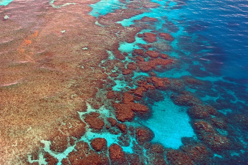
The Great Barrier Reef is considered as the largest living structure in the planet. However, there are no existing biological or geomorphic maps of the individual reefs that make up the Reef.
Although there have been several efforts to map it, today’s charts only outline the location of 3000 reefs that make up the Reef. It does not have the critical biological and geomorphological information.
The Solution
Because of the advancements in technology, it is now possible to fill these gaps. The initiative combined state-of-the-art satellite imagery, bathymetry, slope, wave climate data, modelling techniques, as well as their knowledge of the reef environments.
This mapping builds on more than 20 years of work by remote sensing experts and combines the knowledge of ecologists, Reef managers and citizen scientists.
Developing detailed habitat mapping layers will assist enormously with how the Reef is managed and will underpin all future Reef monitoring and modelling.
What will the maps do?
The maps will be used as a base layer in the development of a Reef knowledge system, which is the online visualisation component of the Reef 2050 Integrated Monitoring and Reporting Program.
Spatial and technical information from the knowledge system will guide and inform resilience-based management decisions.
The multi-spectral data, having high spatial resolution, is captured as satellites pass over the Reef every five days.
Working with an earth observation and environmental services company will allow the combining of data from the satellites with the field validation data, which will confirm the composition of reefs.
This will thereby produce a highly detailed picture of the mid-shore and outer shelf reefs to a depth of up to 10 metres.
Anyone with an interest in the Great Barrier Reef, whether from government or conservation groups, may find this data invaluable.
The new habitat mapping approach will be rolled out over the next 18 months with the maps being available in 2021.
Government support
As project partners, the Australian Institute of Marine Science would develop ecological models to generate additional maps.
They will be using field observations and wave data to create maps of areas likely dominated by different coral types for every individual reef.
The Reef 2050 Integrated Monitoring and Reporting Program is supported by the Australian Government’s Reef Trust.


