


A new website which shows humanity’s impact on the planet using
animated data visualisations , was launched on World Earth Day on 22 April. The
website, EarthTime, was developed by the CREATE Lab (the Community
Robotics, Education and Technology Empowerment Lab) at Carnegie Mellon
University and the World Economic Forum.
It combines satellite imagery from NASA (National Aeronautics
and Space Administration) captured since 1984, with over 300 free, open-source
geospatial datasets. In addition to NASA, current datasets come from the World Bank, the UNHCR,
Berkeley Earth, the Stockholm International Peace Research Institute,
Climate Central, S&P Global, Kudelski, the International Renewable Energy
Agency and WWF, and others. New data providers are being added constantly.
Massive data sets are pre-processed using big-data techniques
to create animated visualisations of high-resolution information at different
time scales. Like with video games, EarthTime uses GPU's in the computer
to create a new capability for interactively exploring extreme-sized data.
The World Economic Forum’s network of experts track
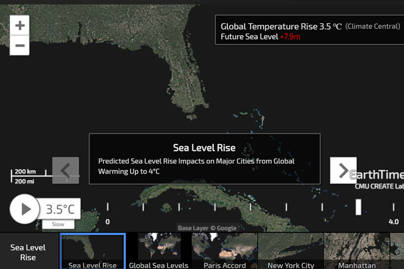
and connect patterns, between a range of topics from deforestation to city
growth, coral bleaching and rise in sea level. These experts on nutrition,
pandemics, climate change, deforestation, refugees help make sense of the
data and allow a layering of narratives, answering questions such as how did
rise in the global demand for meat trigger deforestation, a major contributor
to climate change.
Nine expert analyses on global challenges were launched
on World Earth Day (22
April): deforestation, city growth, coral bleaching, fires at night, glaciers, refugees, renewables, sea-level rise, surface-water gain and
loss and urban fragility.
Other layers will be added in the months and years ahead. Users will soon be
able to create their own stories.

The platform has already been used in public outreach in
schools and museums, and to inform world leaders at World Economic Forum events
of major environmental and geoeconomic shifts, from air pollution to
inequality. It uses images captured by NASA satellites since 1984.
The press release explains that the vision, and long-term
goal of the platform is to better inform individuals, business heads and
policy-makers about the lives we lead, the decisions we make and the impact we
have on the planet.
Illah Nourbakhsh,
Professor of Robotics, Carnegie Mellon University, and Director, CREATE Lab,
said, “EarthTime tries to build the common ground that we believe is essential
to the discourse that we all must have as stewards of our planet and our joint
future. The Earth is changing dramatically. No single discipline can make sense
of all that is now happening and no citizen is free from the consequences of
what we all do next. We all must be involved in understanding Earth's changes
and how we can work together to bring about our desired sustainable future into
reality.”
Lee Howell,
Managing Director, Head of Global Programming, World Economic Forum, said, “For
most leaders, it is difficult to comprehend fully the scale and scope of the
planetary and socioeconomic challenges we face. This pioneering digital
platform allows the business, policy and scientific communities to make better
decisions for our planet through visualization and Big Data.”


